A shot of chilly air will bring the first substantial frost risk of the season
Wednesday brought another beautiful day across central and eastern Kentucky with plenty of sunshine and temperatures reaching the mid to upper 70s. Overnight tonight, a weak wave of energy will pass through, so expect increasing cloud cover. The cloud cover will act like a blanket, keeping temperatures mild. Look for lows falling into the mid to upper 40s.

We may wake up to some cloud cover on Thursday, but we don’t expect any rain because of an extremely dry air mass. Dew points on Wednesday were only in the upper 30s to low 40s.

By Thursday afternoon, sunshine will return, and temperatures have a decent chance of reaching the upper 70s thanks to southwest flow.

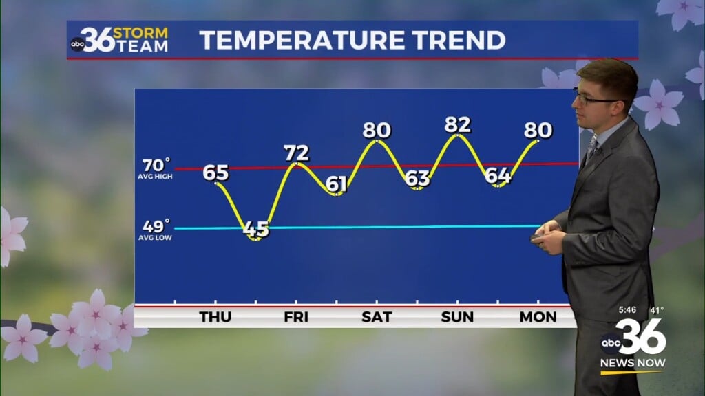
Our weather pattern changes starting early Friday. A strong cold front will push through the Commonwealth, knocking temperatures down significantly. Highs on Friday and Saturday are expected to stay in the low to mid-60s.

The powerful cold front will also open the window for our first widespread frost event of the season. Cool Canadian high pressure will follow the front, and winds will change out of the northwest. Forst is possible both Friday night and Saturday night. Locations in eastern Kentucky might even see a hard freeze late Saturday into early Sunday. Saturday night will be the coldest, with widespread temperatures in the low to mid-30s. Be sure to take time to protect any sensitive plants or vegetation before the cold arrives.

Beyond Sunday, a warming trend will occur. High temperatures should climb from the low to mid-70s throughout the work week, with only minimal chances of rain in the extended forecast.

ABC 36 HOUR FORECAST
WEDNESDAY NIGHT: Clouds build. Lows in the mid to upper-40s.
THURSDAY: A few morning clouds, otherwise pleasant. Highs in the upper 70s.
THURSDAY NIGHT: A few clouds. Lows in the upper-40s.