Colorado Weather: Monsoon Storms Become More Numerous Monday And Tuesday
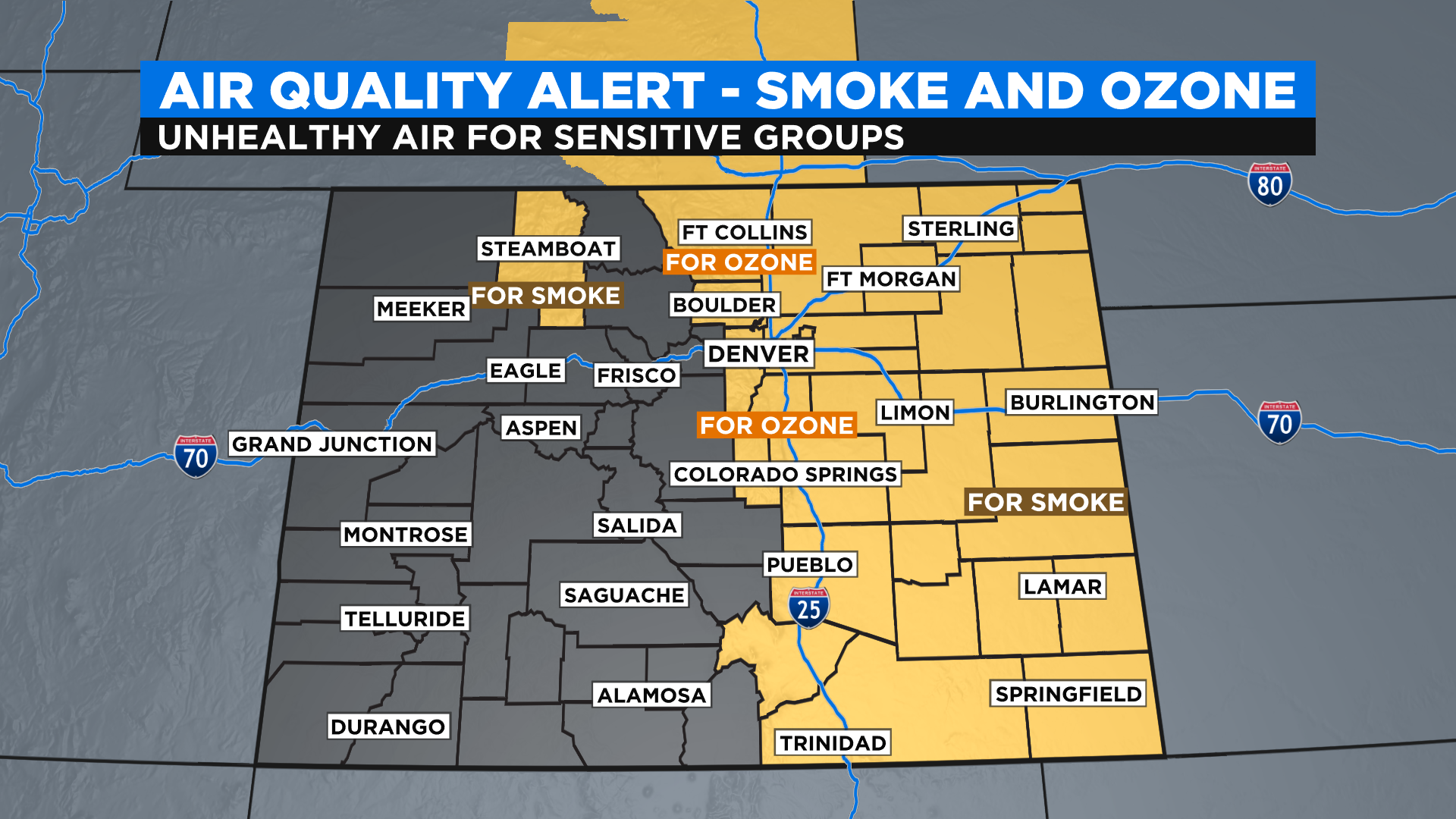
DENVER (CBS4) - The eastern half of Colorado got a much needed break from afternoon thunderstorms on Sunday as a plume of monsoon moisture shifted west of the Continental Divide. But thick wildfire smoke moved in from the north and triggered widespread issues with the air quality. Smoky skies are expected to last through at least Monday along the Front Range and on the eastern plains.
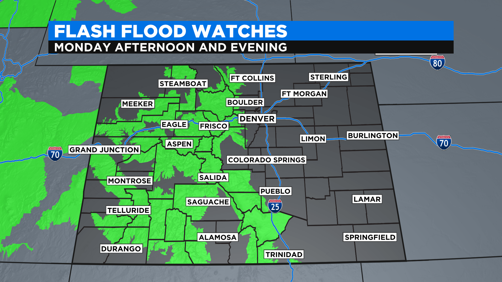
Meanwhile western Colorado remains under a Flash Flood Watch through Sunday evening. Those watches will creep across the Continental Divide and into the Front Range on Monday as the monsoon plume slowly shifts back to the east.
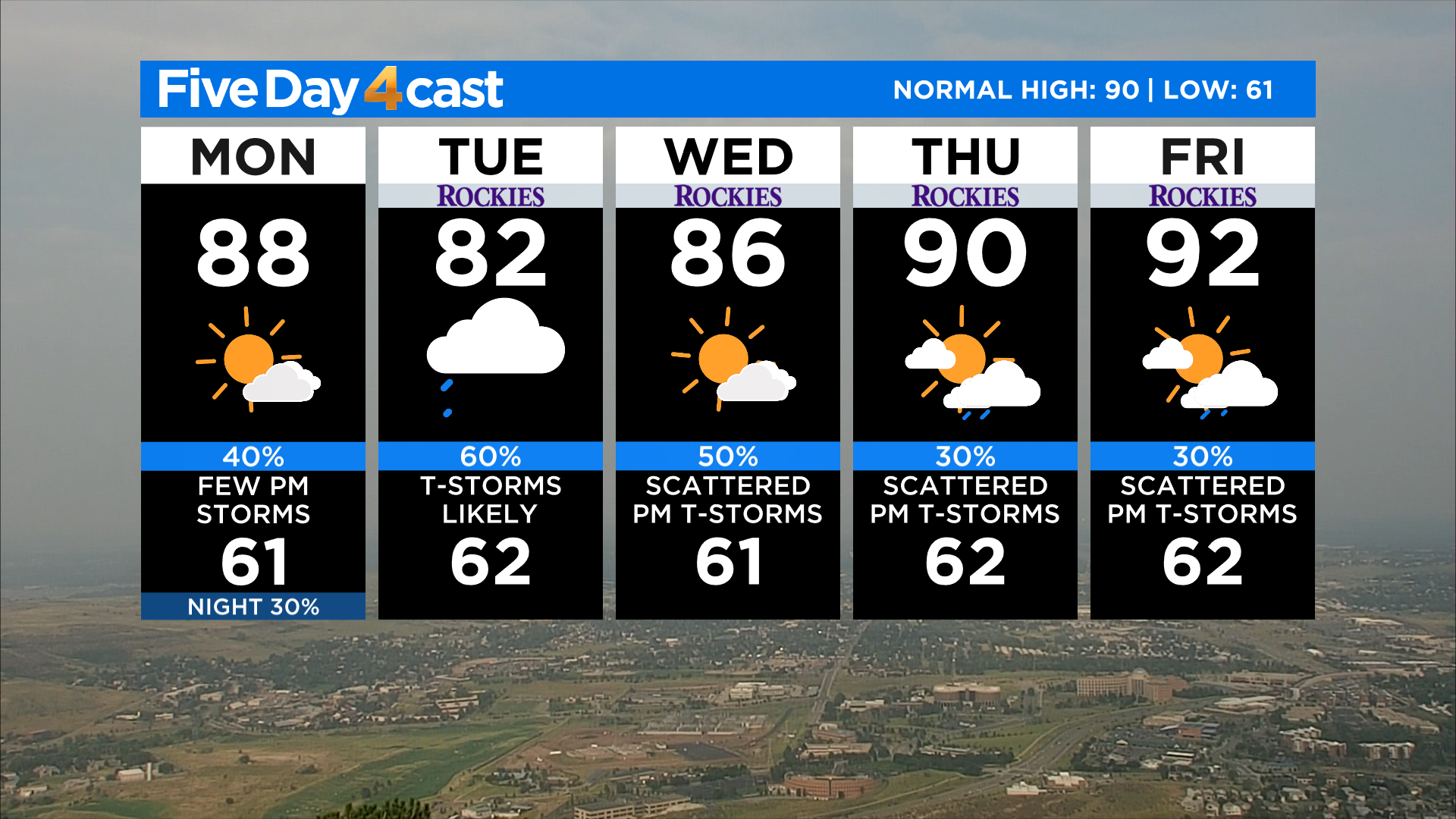
The plume will really park itself over the state on Tuesday with the potential to see widespread showers and storms during the afternoon and evening. Some could even last all night long and linger into Wednesday morning.
This time of the year the upper-level wind speeds over the state are light and therefore storms move slowly, increasing the risk for flash floods. The risk is even higher this year because we have so many fresh and large forest fire burns scars around the state.
Some warmer and drier air will return to Colorado by the middle of the week. Our storm chances won't go away but they should be lower for at least a few days.