

Midday Nowcast: Clouds and Rain Moving into Alabama
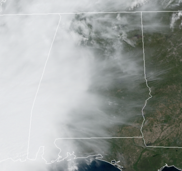
It was a sunny and dry morning, but clouds have been increasing ahead of a cold front which is bringing cooler temperatures, and showers and a few storms are moving back into Alabama as we head into the midday and afternoon hours.
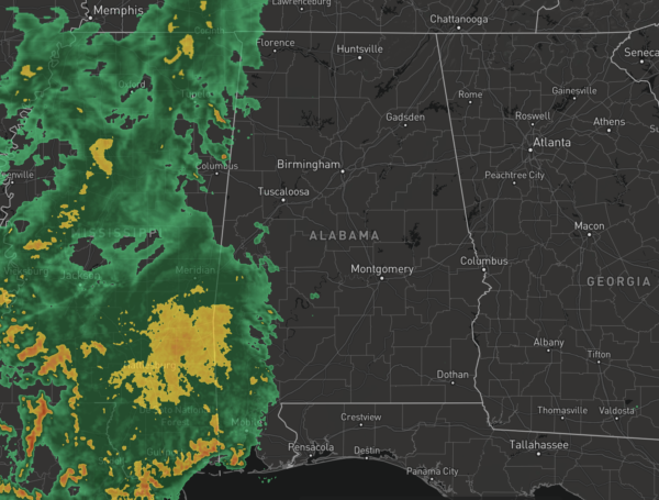
Thankfully, no severe weather for much of the state, but we note the SPC maintains a “marginal risk” (level 1/5) for Mobile, Baldwin, Choctaw, Clarke, and Washington counties, but severe weather won’t be an issue for most of the state. Through the afternoon, it will be mainly cloudy with scattered areas of rain, and periods of rain will continue into and through tonight.
Areas of rain will continue into tomorrow morning, but as the front shifts down into South Alabama the better rain chances will be pushed down towards the Gulf Coast. The sky should become mostly sunny by tomorrow afternoon as drier air works into the state, highs tomorrow will be mainly in the upper 60s to low 70s. Rainfall totals should be in the one-half to one inch range, with the higher amounts across southern portions of the state.
FRIDAY & THE WEEKEND: Clouds begin to increase by Friday as a low develops along the front to south. This feature will spread rain back across Alabama late Friday, Friday night and into Saturday morning. No severe storms, probably no thunder as the air will be cool and stable with temperatures in the 50s and 60s. The rain will shift out of the area by midday and the rest of weekend looks mostly dry. The sky will continue to feature more clouds than sun Saturday afternoon, with highs again in the 60s. Sunday will feature a mix of sun and clouds and highs in the lower 70s.
BEACH FORECAST CENTER: Get the latest weather and rip current forecasts for the beaches from Fort Morgan to Panama City on our Beach Forecast Center page. There, you can select the forecast of the region that you are interested in visiting.
WORLD TEMPERATURE EXTREMES: Over the last 24 hours, the highest observation outside the U.S. was 114.4F at Matam, Senegal. The lowest observation was -94.5F at Vostok, Antarctica.
CONTIGUOUS TEMPERATURE EXTREMES: Over the last 24 hours, the highest observation was 99F at Death Valley, CA. The lowest observation was 3F at Big Sky, MT.
WEATHER ON THIS DATE IN 1873: A famous Easter blizzard raged across Kansas, Nebraska and South Dakota. Gale force winds blew the wet snow into massive drifts, however there were few deaths due to the sparse population and due to the gradual increase of the storm.
Category: Alabama's Weather, ALL POSTS
About the Author (Author Profile)
Macon, Georgia Television Chief Meteorologist, Birmingham native, and long time Contributor on AlabamaWX. Stormchaser. I did not choose Weather, it chose Me. College Football Fanatic. @Ryan_StinnetSubscribe
If you enjoyed this article, subscribe to receive more just like it.


